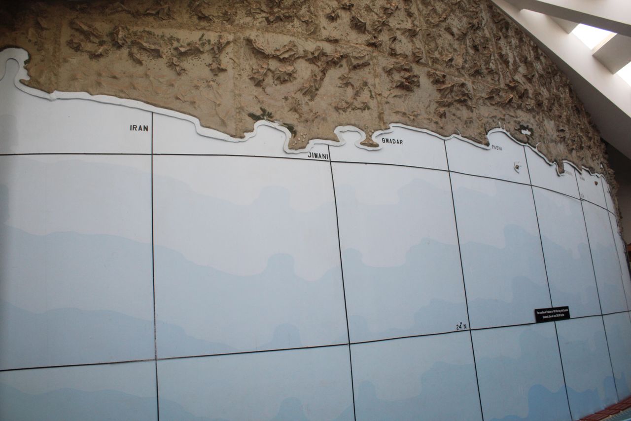
In the background of the whale skeleton, a large mural depicts a 990 km long Pakistan coastline. It serves as the country’s strategic gateway and is bifurcated in two parts: Sindh Coast (270 km) and Makran Coast (720 km) which together form an integral part of Pakistan’s economy. The 990 kilometers long coastline, shared by the coastal provinces of Sindh and Baluchistan, leads into the Maritime Zones of Pakistan. These extend up to 350 nautical miles. Firstly, there are the offshore territorial waters up to 12 nautical miles (22.22 kilometers), then the area between 12 and 20 nautical miles acts as the buffer zone; finally, the area beyond the 20 nautical miles lines up to 200 nautical miles, regarded as the Exclusive Economic Zone (EEZ). The EEZ covers an area of about 240,000 km² of the Arabian Sea. In the year 2015, the EEZ has been further extended by about 50,000 km² through the recognition of Pakistan’s continental shelf claim under UNCLOS (United Nations Convention on the Law of the Sea). Geographically, the coast of Pakistan can be divided into five parts:
• Gwadar Coast • Lasbela Coast • Karachi Coast • Thatta Coast from Korangi Creek up to Indian border at Sir Creek • Rann of Kutch from Badin to Tharparkar Districts